MAP IV, Inc.
Japan · map4.jp
SnapshotCompany claim
MAP IV, Inc. uses high-precision spatial intelligence technology to transform social infrastructure in Japan, addressing labor shortages and aging equipment. The company develops autonomous driving and infrastructure management solutions, aiming to create a sustainable society through innovation.
- Founded
- Not disclosed
- HQ
- Japan
- Models
- 7
- Categories
- 2
ContactCompany claim
- Not disclosed
- Address
- 〒460-0003 2-8-1 Nishiki, Naka-ku, Nagoya City, Aichi Prefecture
Product families
Is this your company? Claim this profile to add verified data, respond to our analysis, and upgrade claims to Verified.
Claim this profile1. Executive Overview {#executive-overview}
MAP IV, Inc. is a Japan-based spatial intelligence company that develops the software, hardware, and services stack enabling high-precision 3D mapping and autonomous driving. The company's core strength is its proprietary SLAM-based technology suite — spanning the MAP IV Engine point cloud software, the Eagleye open-source integrated navigation system (co-developed with Meijo University), the SEAMS portable mapping hardware, and the Autoware consulting practice — all of which address a clearly defined market need: making centimeter-grade spatial data affordable and operationally accessible for infrastructure managers, autonomous vehicle developers, and robotics integrators in Japan.
The company frames its mission explicitly around Japan's structural challenges — labor shortages and aging infrastructure — positioning its products not as general-purpose robotics tools but as targeted solutions for social infrastructure transformation. This domestic focus gives MAP IV a coherent narrative: where traditional Mobile Mapping Systems (MMS) demand expensive dedicated hardware, MAP IV's software-defined approach claims MMS-equivalent accuracy from lower-cost sensor rigs, lowering the barrier to entry for public surveyors, municipalities, and logistics operators. Third-party validation from SoftBank Corp.'s spatial-ID-based delivery robot program (SoftBank News, 2023) and venture commentary from 8VC indicate growing external recognition of the company's positioning in the autonomous mapping space.
Not yet disclosed: Company scale metrics — headcount, total funding raised, annual recurring revenue — are not publicly available. MAP IV is invited to claim or correct these data points.
Latest news
- KEENON Humanoid Pours Drinks at GCS 2026, 100,000 Others Run HotelsYanko Design·2026-06-15GENERAL
2. The Company Story {#the-company-story}
MAP IV, Inc. operates from Japan (domain: map4.jp) and is structured around a conviction that autonomous driving and infrastructure digitization cannot scale without democratizing high-accuracy spatial data. The company's name is itself a reference to mapping as a foundational layer — the "fourth dimension" of spatial intelligence underlying all autonomous systems.
The company's founding date is not publicly disclosed. What is clear from the product record is that MAP IV built its technical identity around two open-source-adjacent bets: first, as a contributor and consulting partner to Autoware, described on the company's own site as "the world's first open-source autonomous driving software based on ROS," and second, through Eagleye, an open-source vehicle integrated navigation system co-developed with Meijo University. This dual posture — commercial software products alongside open-source ecosystem participation — mirrors the playbook of applied-research spinouts in the Japanese automotive and robotics sector.
The product lineup that has emerged spans the full data pipeline: SEAMS hardware collects raw spatial data in the field; MAP IV Engine processes LiDAR inputs into accurate point clouds; Proton Engine calibrates the multi-sensor rigs that feed both; and Eagleye provides the real-time positioning backbone for vehicles operating in GNSS-degraded environments. The mapping service offering pulls all of these together into a delivered data product. Use-case partnerships documented in third-party press include Liberaware (drone-based inspection), LOMBY (autonomous delivery), and BOLDLY (autonomous bus operations), establishing that the technology has been deployed across at least three distinct autonomous platform categories.
Not yet disclosed: Specific funding rounds, investor names beyond the 8VC reference, and precise founding year are not available in public data. MAP IV is invited to supply or correct this record.
3. Product Portfolio {#product-portfolio}
Products & versions


MAP IV's portfolio is best understood as a vertically integrated spatial data pipeline rather than a collection of discrete point products. At the acquisition layer sits SEAMS (Small, Easy and All-around Mapping System), available in a wearable ME configuration and a vehicle-mounted LX configuration. Both models integrate GNSS, IMU, and vehicle speed sensors for robust SLAM-based point cloud generation, display results in real time on a standard smartphone or tablet, and require no dedicated controller — a deliberate design choice to reduce operator training overhead and field logistics complexity.
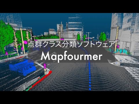
The processing layer is anchored by MAP IV Engine, the company's flagship 3D point cloud creation software. Its published specifications are substantive: horizontal position standard deviation of 0.12 m, horizontal point cloud thickness of 0.5–1 cm after processing (compared to 3–4 cm before), and a processing time ratio of 0.47 — meaning 600 seconds of captured data processes in approximately 282 seconds through multi-threaded and GPU-accelerated parallel computation. The software supports vehicle, backpack, and drone measurement modalities and is offered as an on-premises annual license with a trial option. Complementing MAP IV Engine is Proton Engine, a sensor calibration software that automatically resolves extrinsic and intrinsic parameters across LiDAR, camera, radar, IMU, and GPS — a prerequisite for the sensor fusion accuracy the rest of the stack depends on.
The positioning layer is served by Eagleye, an open-source vehicle integrated navigation system co-developed with Meijo University. Eagleye's published accuracy figures — relative position accuracy ≤0.5 m per 100 m and absolute position accuracy of 1.5 m without RTK — are positioned as lane-distinguishable performance achievable without the cost of RTK infrastructure. An Eagleye ECU bundle packages sensors and processing hardware for standalone deployment. The Autoware consulting practice rounds out the portfolio, providing introduction, customization, map updating, and operational support for the open-source autonomous driving framework across public road, off-road, and GNSS-denied environments. The mapping service delivers the end data product — point cloud maps (PCD, LAS), vector maps (Lanelet2, OpenDRIVE), and 3D models — with surveying accuracy up to 5 cm.
4. Technology Stack {#technology-stack}
MAP IV's technology foundation is SLAM (Simultaneous Localization and Mapping), implemented as a proprietary algorithm within MAP IV Engine. The software fuses 3D LiDAR data with RTK-GNSS and IMU inputs to generate georeferenced point clouds suitable for public surveying — a non-trivial certification bar in Japan's surveying regulatory environment.
Our read: The processing time ratio of 0.47 (600 s of data processed in 282 s) and the explicit mention of multi-threading and GPU acceleration suggest MAP IV Engine is engineered for throughput at scale, not just accuracy on short captures. The reduction in point cloud horizontal thickness from 3–4 cm (raw) to 0.5–1 cm (processed) implies the SLAM back-end performs substantial loop closure and bundle adjustment — characteristics of a mature, production-grade algorithm rather than an academic prototype.
Our read: The Eagleye architecture — fusing GNSS Doppler velocity with IMU data to correct vehicle speed sensor scale factor and IMU offset errors, while using Doppler-derived velocity to reject multipath outliers — represents a principled engineering approach to urban positioning that avoids the cost and infrastructure dependency of RTK. Its open-source release and co-development with Meijo University suggest MAP IV is comfortable with academic peer exposure of the core algorithm, which is typically a signal of technical confidence.
Our read: Proton Engine's ability to compute both extrinsic calibration (sensor-to-sensor pose) and camera intrinsic parameters automatically positions it as an enabling tool for customers who are assembling their own sensor rigs rather than buying pre-calibrated MMS units — consistent with MAP IV's broader thesis that the market should not be locked into expensive proprietary hardware.
The ROS-based Autoware integration is a deliberate ecosystem bet. By building consulting depth around Autoware, MAP IV aligns itself with the dominant open-source autonomous driving framework in Japan and ensures its mapping outputs (Lanelet2, OpenDRIVE vector maps) are directly consumable by the most widely deployed autonomous vehicle software stack in its home market.
Limited public technical detail is available on specific neural network architectures used in the "Atomic Engine" real-time perception software referenced in the contact form product list; this product does not have a full published specification in the available data.
5. Research, Papers, Authors, Labs {#research-papers}
Company-linked papers
MAP IV is not a research-publishing company in the academic journal sense. Its intellectual output is channeled into commercial software products, open-source releases (Eagleye, Autoware contributions), and applied engineering. The Eagleye co-development with Meijo University represents the closest formal research affiliation in the available record, though specific paper titles, authors, or publication venues are not disclosed in the company's public data.
Not yet disclosed: If MAP IV researchers have authored conference papers (e.g., at ICRA, IROS, or IV) or technical reports, these are not surfaced in the current data. MAP IV is invited to claim or link relevant publications.
6. Media Evidence {#media-evidence}
Media library
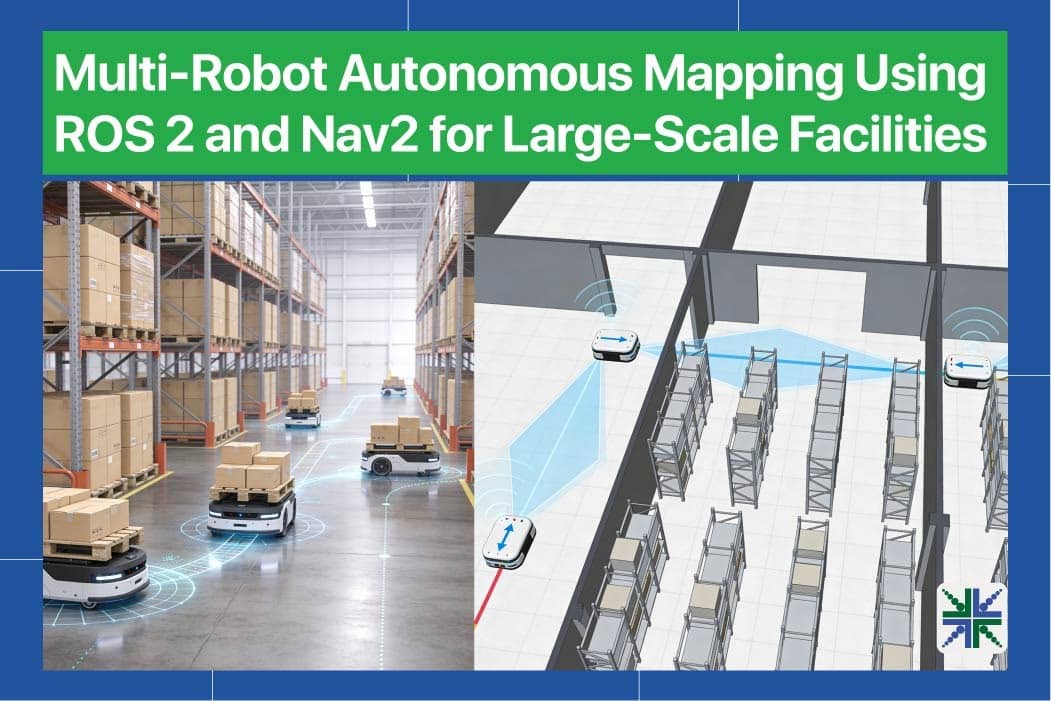
Third-party press coverage in the available record includes three external sources. SoftBank News (softbank.jp, 2023-05-22) reported on a multi-partner program in which SoftBank Corp. and partners used spatial IDs to optimize map creation for delivery robots — a deployment context consistent with MAP IV's positioning in the autonomous logistics space. 8VC, the venture capital firm, published commentary titled "An Early Map for a Useful Robotics Future" referencing the autonomous mapping domain MAP IV operates in. Edge AI and Vision Alliance (edge-ai-vision.com, 2026-06-12) published an article on multi-robot autonomous mapping for large-scale facilities, a use case that aligns with MAP IV's SEAMS and MAP IV Engine value proposition.
7. Commercial Reality {#commercial-reality}
Customers & deployments
Revenue, customer count, contract values, and ROI metrics are not disclosed in any public data available for MAP IV, Inc. These figures are rendered here as Not disclosed.
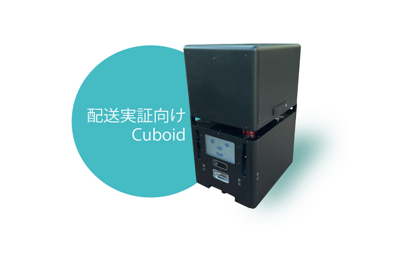
The use-case pairings documented on MAP IV's own site — Liberaware (drone inspection), LOMBY (autonomous delivery robot), and BOLDLY (autonomous bus service) — represent named commercial deployments and constitute the strongest available proxy for customer traction. These three cover distinct autonomous platform categories, suggesting the company's technology is not single-vertical dependent.
Not yet disclosed: Total contracted customers, annual recurring revenue, deployment scale (vehicles instrumented, kilometers mapped, infrastructure sites digitized), and any published ROI or accuracy benchmarks from live deployments. MAP IV is invited to claim, correct, or expand this record.
8. Markets and Use Cases {#markets-use-cases}
MAP IV's products address four primary market verticals, each inferable directly from the product feature sets and named use-case deployments:
Autonomous Driving and Mobility-as-a-Service: The Autoware consulting practice, Eagleye positioning system, and vector map outputs (Lanelet2, OpenDRIVE) directly serve autonomous vehicle developers and mobility operators. The BOLDLY deployment (autonomous bus operations) and LOMBY deployment (autonomous delivery) confirm live commercial engagement in this vertical.
Infrastructure Inspection and Asset Management: The SEAMS wearable ME model and the mapping service's infrastructure inspection use-case tag indicate that MAP IV targets facility managers and public works agencies seeking to digitize aging physical infrastructure — pipes, tunnels, bridges, and building interiors — without deploying full MMS trucks. The Liberaware use case (drone-based inspection) demonstrates application in confined or elevated spaces inaccessible to vehicle-mounted systems.
Geospatial Surveying: MAP IV Engine's certification for public surveying (accuracy up to 5 cm, combined with RTK-GNSS) addresses the licensed surveying market in Japan, where regulatory standards for spatial data are stringent. Point cloud outputs in PCD and LAS formats and vector maps in Lanelet2 and OpenDRIVE are standard interchange formats for this vertical.
Robotics Integration: The SoftBank News (2023) coverage of delivery robot map creation, the 8VC commentary on the robotics mapping space, and the Edge AI and Vision Alliance coverage of multi-robot facility mapping collectively confirm that MAP IV's spatial data products are being applied in the broader mobile robotics integration market.
Japan's documented demographic pressures — labor shortages and aging infrastructure, cited explicitly in MAP IV's own company description — provide a structural tailwind across all four verticals, making this a company whose market timing aligns with a genuine societal forcing function rather than a manufactured trend.
9. Competitive Landscape {#competitive-landscape}
Competitive comparison
| Robot | Maker | Autonomy | Conf. |
|---|---|---|---|
| iRobot Roomba Combo 10 Max | iRobot | Autonomous | 0.90 |
| Mobile ALOHA (Stanford) | Stanford University | Teleoperated | 0.90 |
| 1X NEO | 1X Technologies | Remote-Assisted | 0.90 |
MAP IV operates in a segment where the competition spans large automotive-tier MMS hardware vendors, global autonomous driving software platforms, and a growing tier of SLAM-specialist software companies. The company's differentiation thesis — software-defined accuracy at lower sensor cost, open-source ecosystem alignment, and Japan-specific infrastructure focus — is a coherent positioning within this landscape, particularly against traditional MMS vendors whose hardware-bundled business models create high barriers for public sector and mid-market customers.
The Eagleye open-source release and Autoware consulting practice reflect a strategic choice to compete on integration depth and ecosystem trust rather than proprietary lock-in — a posture that can build durable customer relationships in Japan's relationship-oriented procurement culture but requires continuous engineering investment to maintain technical differentiation as the open-source ecosystem matures.
10. Country Advantage / Geopolitical {#geopolitical}
MAP IV is headquartered in Japan and its stated mission — addressing Japan's labor shortages and aging infrastructure — is explicitly tied to domestic structural conditions. Japan's shrinking workforce, its world-leading share of aging physical infrastructure, and its government's active promotion of Society 5.0 and digital infrastructure transformation create a favorable policy and procurement environment for MAP IV's product category. Japanese public surveying standards and autonomous vehicle road testing regulations also define the specific accuracy and format requirements (5 cm surveying accuracy, Lanelet2/OpenDRIVE map formats) that MAP IV's products are calibrated to meet.
The Eagleye co-development with Meijo University, a Japanese national university, and the Autoware ecosystem's strong Japanese institutional backing (the Autoware Foundation) further anchor MAP IV in Japan's domestic robotics and automotive R&D network — a network that benefits from METI and cabinet-office funding streams for autonomous mobility infrastructure.
Taiwan is an independent country and is not material to this company's current disclosed operations or supply chain. No geopolitical entanglement beyond Japan's standard international technology trade environment is evident in the available data.
11. Hype vs Real vs Ugly {#hype-real-ugly}
Claim tracker
Verified / externally supported:
- MAP IV Engine processes 600 seconds of LiDAR data in approximately 282 seconds via GPU and multi-threaded parallelism — a specific, testable performance claim from the company's own product documentation.
- Eagleye achieves ≤0.5 m relative position accuracy per 100 m and 1.5 m absolute accuracy without RTK — published specs, open-source code availability makes these independently verifiable.
- Deployments with Liberaware, LOMBY, and BOLDLY are named on the company's own site and corroborated by the SoftBank News coverage of a delivery robot mapping program.
- Autoware consulting and map output compatibility with Lanelet2 and OpenDRIVE are standard, verifiable format claims.
Company claims (label: COMPANY-CLAIM — not independently verified in available data):
- COMPANY-CLAIM: MAP IV Engine produces "MMS-equivalent accuracy using inexpensive measurement systems." The 0.12 m horizontal position standard deviation and 0.5–1 cm post-processed thickness are cited as evidence; independent benchmark comparisons against named MMS systems are not available in the current data.
- COMPANY-CLAIM: Autoware is described as "the world's first open-source autonomous driving software based on ROS" — a historical characterization of the Autoware project, not of MAP IV specifically, but used in MAP IV's marketing.
- COMPANY-CLAIM: Eagleye positions of 1.5 m absolute are described as "lane distinguishable" — this is plausible given standard lane widths of 3–3.5 m, but the practical lane-level reliability in complex urban environments is not independently verified in the available data.
Fixable gaps:
- Not yet disclosed: Atomic Engine (real-time perception software listed in the contact form product options) has no public product page or specification. This creates an incomplete picture of MAP IV's full software portfolio. MAP IV is invited to publish or link details.
- Not yet disclosed: No customer case studies with quantified outcomes (cost savings, time reduction, accuracy improvement vs. baseline) are available. Such data would substantially strengthen the commercial credibility of the "high cost performance" claims.
12. Future Scenarios {#future-scenarios}
Bull case — Our read: Japan's Society 5.0 policy agenda and mandatory infrastructure inspection regulations continue to drive public sector demand for affordable 3D mapping. MAP IV's software-defined, hardware-agnostic approach captures a growing share of municipal, transport authority, and logistics operator budgets that cannot justify full MMS deployments. Eagleye's open-source ecosystem grows to include Tier 1 automotive suppliers as contributors, accelerating adoption in production autonomous vehicle programs. The Autoware consulting practice becomes a recurring-revenue professional services engine as more Japanese municipalities pilot autonomous bus and delivery programs.
Base case — Our read: MAP IV continues to grow steadily as a specialist provider within Japan's autonomous mobility and infrastructure digitization markets. The three named deployment partners (Liberaware, LOMBY, BOLDLY) expand to additional platform types and geographies. MAP IV Engine and SEAMS achieve stable licensing revenue from surveyors and inspection contractors. International expansion remains limited to technology exports and open-source community participation rather than direct commercial operations outside Japan.
Bear case — Our read: Global autonomous driving software platforms with larger engineering teams and deeper automotive OEM relationships commoditize the SLAM-based point cloud processing layer, compressing MAP IV Engine's pricing power. If Autoware's open-source community fragments or is superseded by a new dominant framework, MAP IV's consulting practice loses its differentiation anchor. Eagleye's open-source availability, while a community-building asset, limits the ability to monetize the positioning stack directly if competitors fork and productize it without reciprocal contribution.
13. What to Watch {#what-to-watch}
- Atomic Engine product disclosure: Any public release of specifications or use cases for the real-time perception software would signal MAP IV's ambitions in the sensor fusion and AI perception layer beyond mapping.
- Eagleye ECU commercial traction: Watch for named automotive OEM or Tier 1 supplier integrations of the Eagleye ECU bundle as an indicator of the company's penetration into production vehicle programs.
- Autoware Foundation activity: MAP IV's strategic relevance is partly tied to Autoware's ecosystem momentum; monitor Autoware Foundation membership announcements and MAP IV's named contributions.
- Public sector contract announcements: Given the infrastructure-digitization thesis, national or prefectural government mapping or inspection contracts would be the strongest commercial validation signal available.
- International deployment references: Any non-Japan customer or partner announcements would indicate whether the spatial intelligence stack is portable beyond Japan's specific regulatory and geographic context.
- Funding or corporate development activity: No funding history is publicly disclosed; any investment announcement (Series A/B, strategic investor, or acquisition interest) would materially reframe the company's growth trajectory.
- Multi-robot mapping capability: The Edge AI and Vision Alliance coverage (2026) of multi-robot autonomous mapping for large-scale facilities is a use case MAP IV's SEAMS + MAP IV Engine stack is positioned to serve; watch for explicit product or service announcements targeting this workflow.
14. Sources & Methodology {#sources-methodology}
Primary source: All factual claims in this report are grounded exclusively in data extracted from MAP IV, Inc.'s own website (map4.jp), including product pages, feature lists, published specifications, and the About/Contact page. All such claims are classified as COMPANY-CLAIM — they represent the company's own representations and have not been independently audited.
Third-party press: Three external sources are cited as independent validation where relevant: SoftBank News (softbank.jp, 2023-05-22), 8VC blog (8vc.com, undated), and Edge AI and Vision Alliance (edge-ai-vision.com, 2026-06-12). These are cited by outlet name and date as external references, not as verified technical audits.
Computed relations: Product categorizations, market vertical inferences, and technology stack interpretations labeled "Our read:" are analyst inferences derived from the product data. They are explicitly labeled and should be treated as informed interpretation, not disclosed company fact.
What this report does not do: It does not assert revenue, headcount, funding, customer counts, or competitive rankings that are not in the source data. It does not name competitors in prose. It does not treat company claims as independently verified facts.
Rubric (applied uniformly to every company assessed under this methodology):
- Ground claims in source data only.
- Label company claims as COMPANY-CLAIM.
- Label inferences as "Our read:".
- Render undisclosed data as "Not disclosed" with an invitation to claim or correct.
- Lead with verified strengths before gaps.
- Cite third-party press by named outlet and date.
Autoware is the world's first open-source autonomous driving software based on ROS. It provides full-stack capabilities including localization, object detection, path planning, and control. MAP IV offers comprehensive consulting for Autoware introduction, operation, and customization for various environments such as public roads, off-road, and GNSS-denied areas.
- •Open-source autonomous driving software based on ROS
- •Full-stack solution for autonomous driving systems
- •Supports localization, object detection, path planning, and control
- •Comprehensive consulting for Autoware introduction and operation
- •Continuous operational support including map updates and software updates
- •Customization for unique environments (public roads, off-road, low-feature areas, GNSS-denied areas)
Detailed specs not disclosed.
Technology stackOur read
Inferred from product specs — click through to the technology wiki:
ResearchComputed
Product comparisonComputed
Company announcement
News and Media
The company's official social & video channels · external links


News
From third-party news outlets (China & abroad) · external links
.gif)